
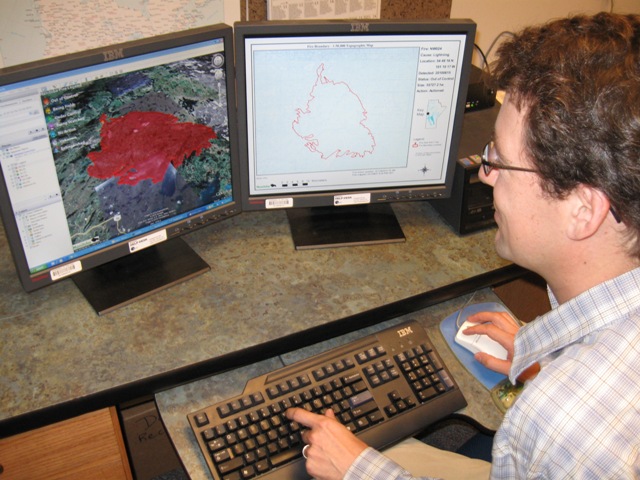
Archived Fire Maps
The Manitoba Wildfire Service provides an interactive Fireview map, as well as fire location maps formatted for viewing in Google Earth (2026 Fires KMZ) and in industry standard ESRI shapefile format (2026 Fire ZIP). These operational map products are a compilation of data from various sources including the crews who suppress the fires, satellite data, and hand rendered maps. The maps are updated daily between 11:30 AM and 3:30 PM, and are provided in an "as is" condition complete with any errors and omissions that may have occurred.
The maps reflect the best information electronically available at the moment the map was created. The fire shapes and sizes may differ from the actual fire occurrence due to changing weather conditions and a variety of natural, electronic, and human factors beyond the control of Manitoba Economic Development, Investment, Trade and Natural Resources.
Fire sizes are generally increasing during the active fire months, and more static during the over winter non fire period. It should be noted that final sizes and shapes may change during the off season period, as corrections are made in preparing a final mapped layer for the season.
A text listing of all 2026 fires to date can be found here.
Archived Data
2025 Shapefile
2020 Shapefile
2019 Shapefile
2018 Shapefile
2018 Google Earth KMZ
2017 Shapefile
2017 Google Earth KMZ
2016 Shapefile
2016 Google Earth KMZ
2015 Shapefile
2015 Google Earth KMZ
2014 Shapefile
2014 Google Earth KMZ
2013 Shapefile
2013 Google Earth KMZ
2012 Shapefile
2012 Google Earth KMZ
2011 Shapefile
2011 Google Earth KMZ
2010 Shapefile