Manitoba Ag Weather Program
The program is always expanding and improving to provide more reliable data, particularly in areas that lack adequate coverage. Producers interested in hosting a weather station around the identified areas of future planned installations should ensure that the proposed location meets the site selection criteria.
The program has three main goals:
- Improving weather monitoring across agricultural Manitoba
- Encouraging partnerships and sharing of weather information
- Developing value-added tools to assist decision-making by Manitoba producers
Weather monitoring stations
The Manitoba government operates about 120 automated near real-time permanent weather stations. These stations complement the automated weather stations of Environment Canada and other networks.
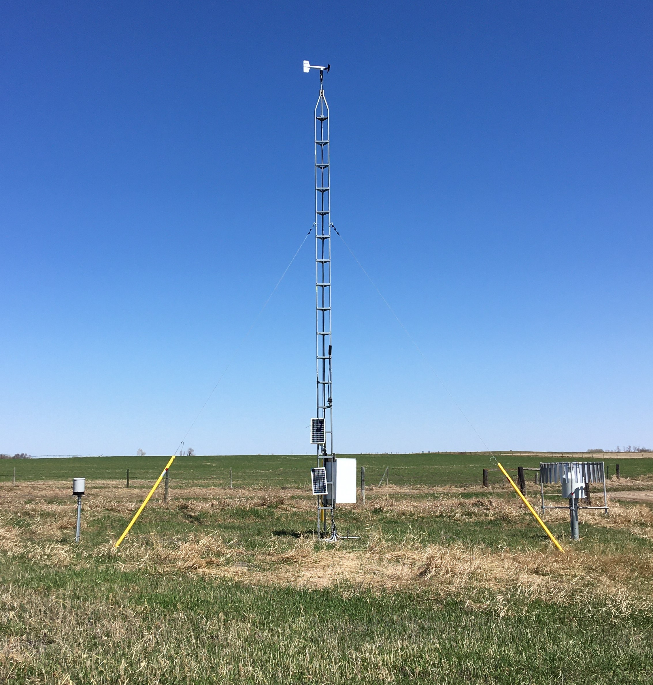 Manitoba Ag Weather Program Station: Findlay (2020) |
|
Weather station measurements and sensors
Air Temperature (°C)
Air temperature is measured using a Vaisala HMP 155 temperature and relative humidity sensor at a height of 2 m above ground level.
Relative Humidity (%)
Relative Humidity is a measurement of the amount of water vapour in the air relative to the amount of moisture required to saturate that air at the same temperature. Relative humidity is measured using a Vaisala HMP 155temperature and relative humidity sensor, mounted at 2 m above ground level.
Delta T (°C)
Delta T is defined as the difference between the wet bulb temperature and the dry bulb temperature. In the absence of a wet bulb temperature, Delta T is calculated from air temperature and relative humidity. It provides an indication of evaporation conditions and can be used in making spray decisions. Ideal Delta T is between 2°C and 8°C. High Delta T indicates dry air which may result in faster evaporation, while low Delta T indicates moist air and slower evaporation.
Precipitation (mm)
Total precipitation is the amount of liquid or solid water particles formed by condensation of water vapour in the atmosphere. Total precipitation (including liquid snow) is measured using an OTT HydroMet Pluvio2 400 All-Weather Precipitation Gauge. Precipitation is measured year-round.
Wind Speed (km/hr) and Wind Direction (°)
Wind Speed and wind direction are measured using an RM Young propeller anemometer mounted at the top of the 10 m tower. Sensors are calibrated or replaced every three years.
Soil Temperature (°C)
Soil Temperature is measured at four depths: 5 cm, 20 cm, 50 cm, and 100 cm. All sensors are buried beneath grass cover. At 5 cm, soil temperature is measured using a CS109L Campbell Scientific probe. Soil temperature all other depths are measured using Delta-T ML3 Theta Probes which also measure soil moisture.
Soil Moisture (%)
Soil moisture is measured as Volumetric Water Content. This is measured as a percentage of the volume of water, relative to the amount of soil at a given depth. Soil Volumetric Water Contant is measured using Delta-T ML3 Theta probes installed at 5 cm, 20 cm, 50 cm, and 100 cm depths. These are installed at the base of the weather station tower beneath a grass surface. Please note, soil moisture can very greatly over short distances. Soil moisture values are not valid when ground is frozen.
Pressure (hPa)
Also called sea level pressure, pressure is measured using a Vaisala PTB100 housed within the weather station enclosure box at approximately 1.5 m. Elevation at each location is adjusted for reference to sea level.
For detailed summary of our weather stations and network, please see The Manitoba Agriculture Mesonet: Technical Overview