
Historic Floods
Introduction
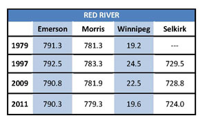
Spring Flood Peaks (feet above sea level
Winnipeg is based on James Ave. datum)
Manitobans have experienced major floods for centuries. In the past 60 years, the floods in 1950, 1997, 2009 and 2011 have caused substantial damage, especially along the Red River and Assiniboine River basins. At the same time, Manitoba's flood fighting efforts have improved greatly and have significantly reduced the number of evacuations and the amount of damage spring and severe summer flooding can cause.
The largest flood in the recorded history of Manitoba took place on the Red River in 1826 and was 40 percent larger than the 1997 flood. It is estimated that a repeat of an 1826 level flood without the Red River Floodway, Portage Diversion Shellmouth Reservoir, and Winnipeg's primary dikes would result in more than $5 billion in damages.
Top 10 Red River Floods since 1800
Historic Flood Events
Historic Flood - 1826
An excerpt from Some observations on peak stages during the 1826 Red River flood and the “Fleming Conundrum” (Prairie Perspectives, Vol. 6, WF Rannie, University of Winnipeg) The 1826 flood was the largest known in the Red River Valley, with an estimated peak discharge about 40 per cent greater than the natural flow in the 1997 flood. The conditions that caused the 1826 flood have been described in detail by St. George and Rannie (2003). The event devastated the struggling Red River Settlement, led to the exodus of German and des Meurons regiment settlers, precipitated the relocation of the Hudson’s Bay Company headquarters from Upper Fort Garry (in present-day Winnipeg) to flood-free Lower Fort Garry (near Selkirk, 40 kilometres downstream). It also figured prominently in the 1870s debate about the location of the railway crossing of the Red River. Moreover, the flood had effects that reached beyond its importance in the early history of the Winnipeg region. Indeed, it can be speculated that without the example of the severe flood threat 1826 provided, a lower, more common, and less expensive standard might have been adopted for the flood protection system for Winnipeg after 1950. Had that been the case, it is unlikely that Winnipeg would have escaped major damage from the 1997 flood. |
 Generalized extent of 1826 flood in Manitoba (WF Rannie) |
Articles on the flood of 1826:
- “Some observations on peak stages during the 1826 Red River flood and the ‘Fleming Conundrum’” (Prairie Perspectives, 6, WF Rannie, University of Winnipeg)
- “The Causes, Progression and Magnitude of the 1826 Red River Flood In Manitoba” (S St. George, B Rannie, Canadian Water Resources Journal, 2003)
- “Red River Flood – 1826” (Manitoba Pageant, Spring 1966, Volume 11, Number 3)
- “The role of the Assiniboine River in the 1826 and 1852 Red River flood” (Prairie Perspectives, Vol 5, WF Rannie, University of Winnipeg)
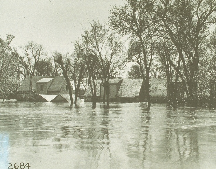
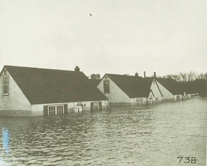
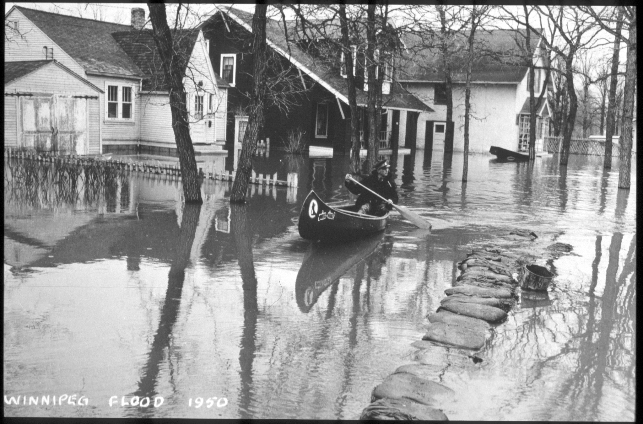
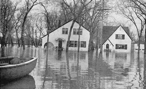
Historic Flood - 1950
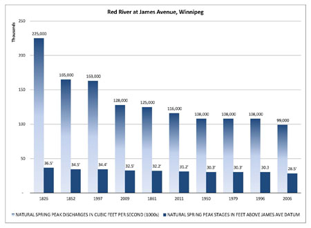
The 1950 flood was the largest flood in the Red River Valley since 1861. Major flooding took place in Winnipeg and the Red River Valley in April, May and June. The melting of heavy snow caused the Red River to reach flood levels in Winnipeg by April 22. A heavy rainfall in early May caused the river to peak at a 9.2 metres (30.2 feet) at James Avenue in Winnipeg. The levels stayed above the flood stage for 51 days. The water depth reached 4.6 metres (15 feet) in low lying areas. Heavy snow during the previous winter and heavy spring rain contributed to flood conditions.
|
Flood areas in 1950 |
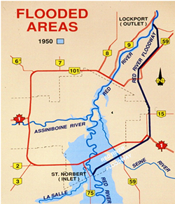
A state of emergency was declared and the Canadian Army and Red Cross were brought in to help protect residents and property and help with evacuations. Over the course of the flood, 100,000 residents (one third of Winnipeg) were evacuated from their homes - the largest evacuation in Canadian history (until the 1979 Mississauga train derailment). Approximately 10,000 homes were destroyed and 5,000 buildings were damaged. It was estimated that the 1950 flood resulted in $125.5 million in damages (about $1 billion in today's figures.)
 |
 |
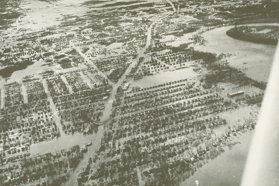
An aerial photo showing flooding in the St. Vital area, 1950 |
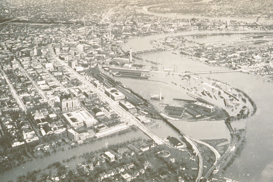
An aerial photo showing flooding in the former CNR rail yards at The Forks in downtown Winnipeg, 1950 |
 |
 |
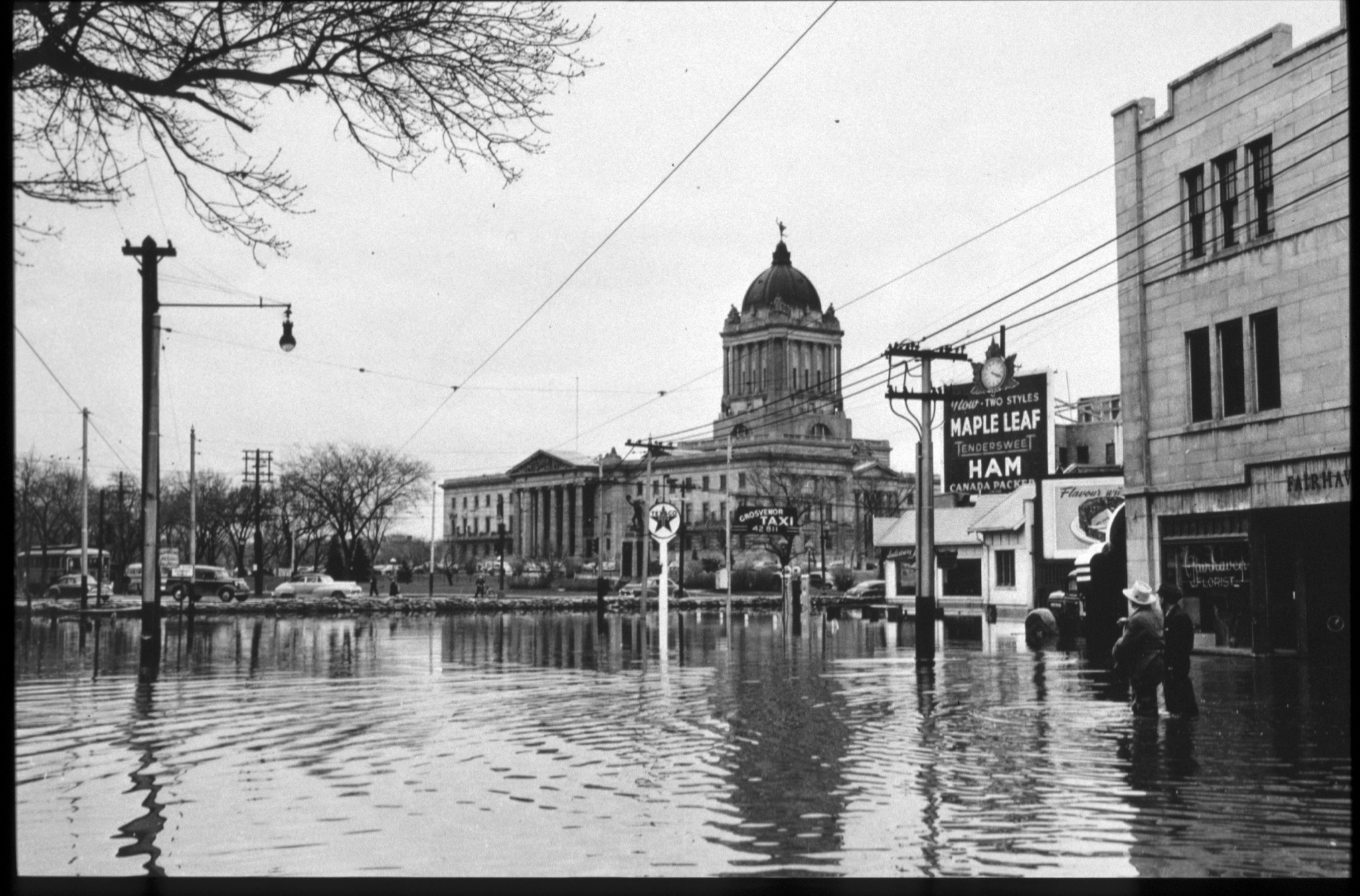
View of the Manitoba Legislative Building seen from the flooded Broadway Avenue in Winnipeg, 1950 |
View of Assiniboine Avenue flooded in 1950 |
 |
 |
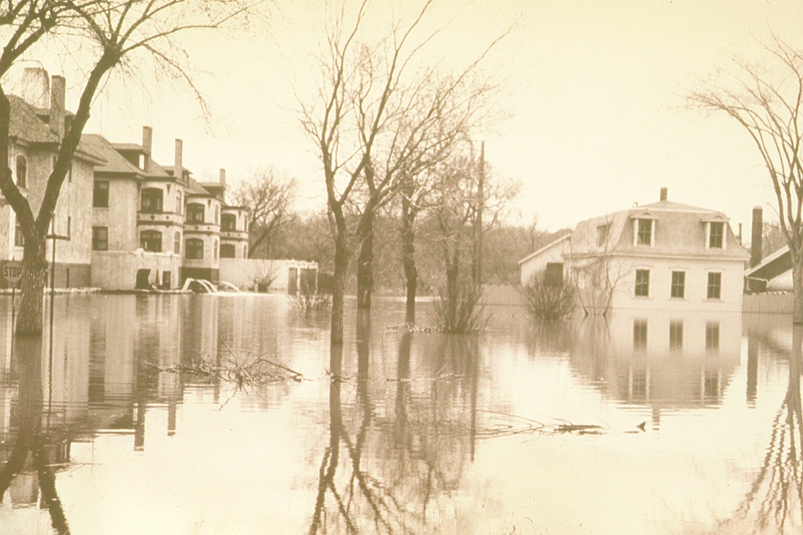
View of Elm Park in Fort Garry flooded in 1950 |
View of flooded homes in the Fort Rouge area, 1950 |
 |
 |
| Image of man canoeing in a flooded residential area, 1950 | Flooded homes on Scotia Street, 1950 |
 |
 |
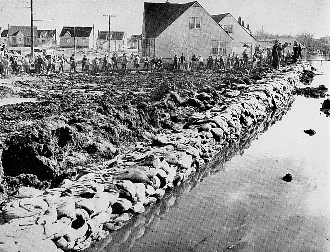
Volunteers sandbagging Winnipeg streets, 1950 |
Water being held back by the Glenwood Crescent Dike, 1950 |
 |
 |
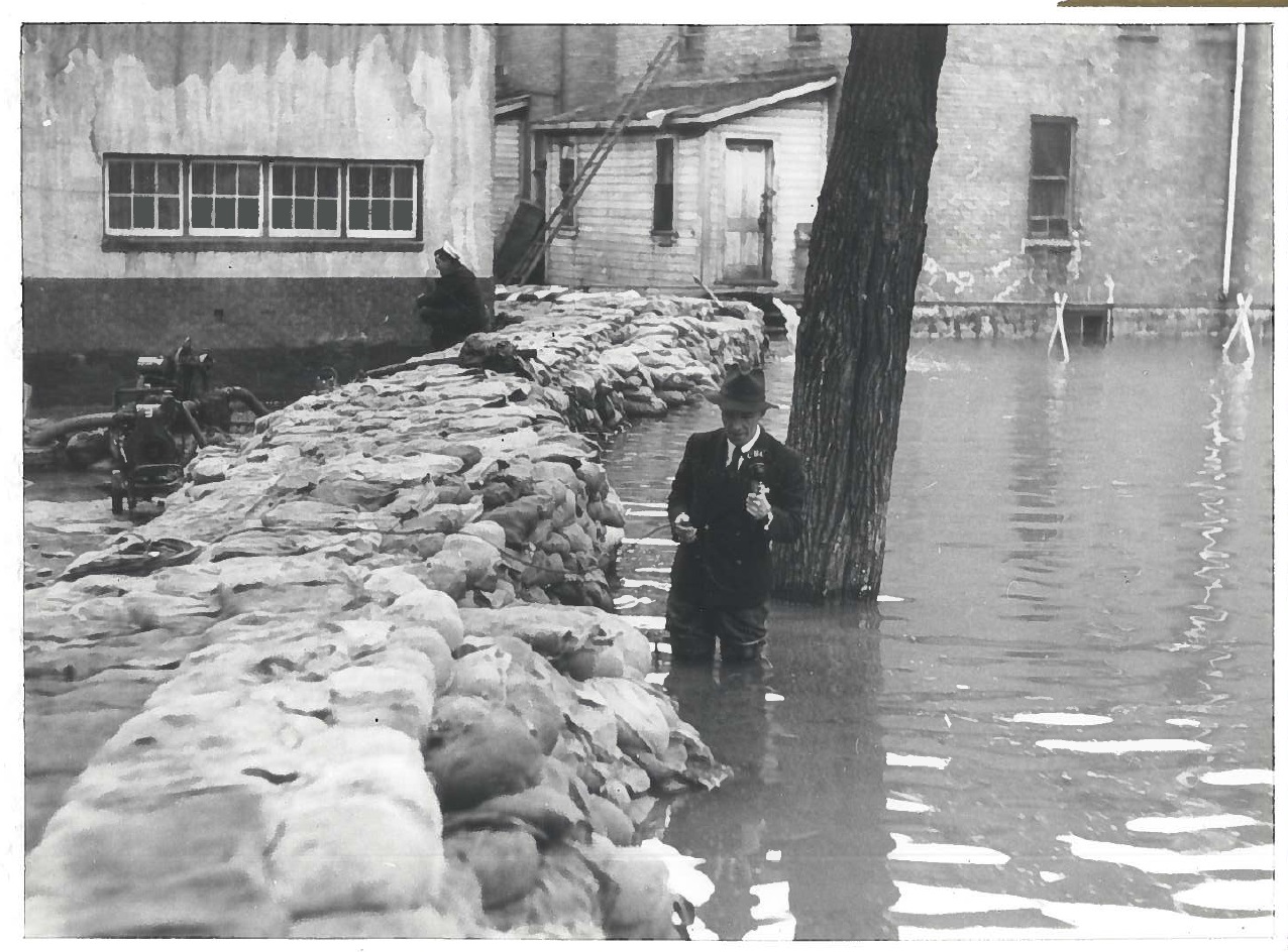
News anchor standing in knee deep water behind a sandbag dike while covering a story, 1950 |
Trucks driving on a raised road through a flooded commercial area, 1950 |
 |
 |
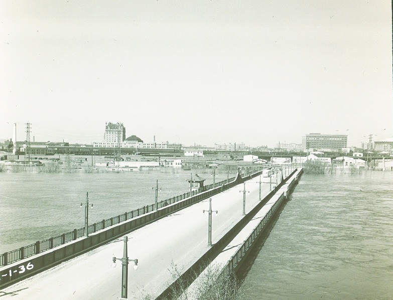
Flood waters almost reaching the height of the old Provencher Bridge, 1950 |
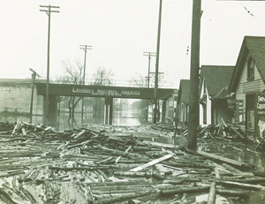
Debris scattered under a flooded CNR Line, 1950 |
Reports
Please visit the reports page for all Red River Flood Reports
Links
- http://www.collectionscanada.gc.ca/sos/002028-1200-e.html?PHPSESSID=gj191qoh91idmvrkkv03trjco2
- http://www.cbc.ca/archives/entry/a-city-submerged-winnipeg-and-the-flood-of-1950
- http://www.canadashistory.ca/Magazine/Trading-Post/Trading-Post-List/Articles/Record-Manitoba-Flood-of-1950
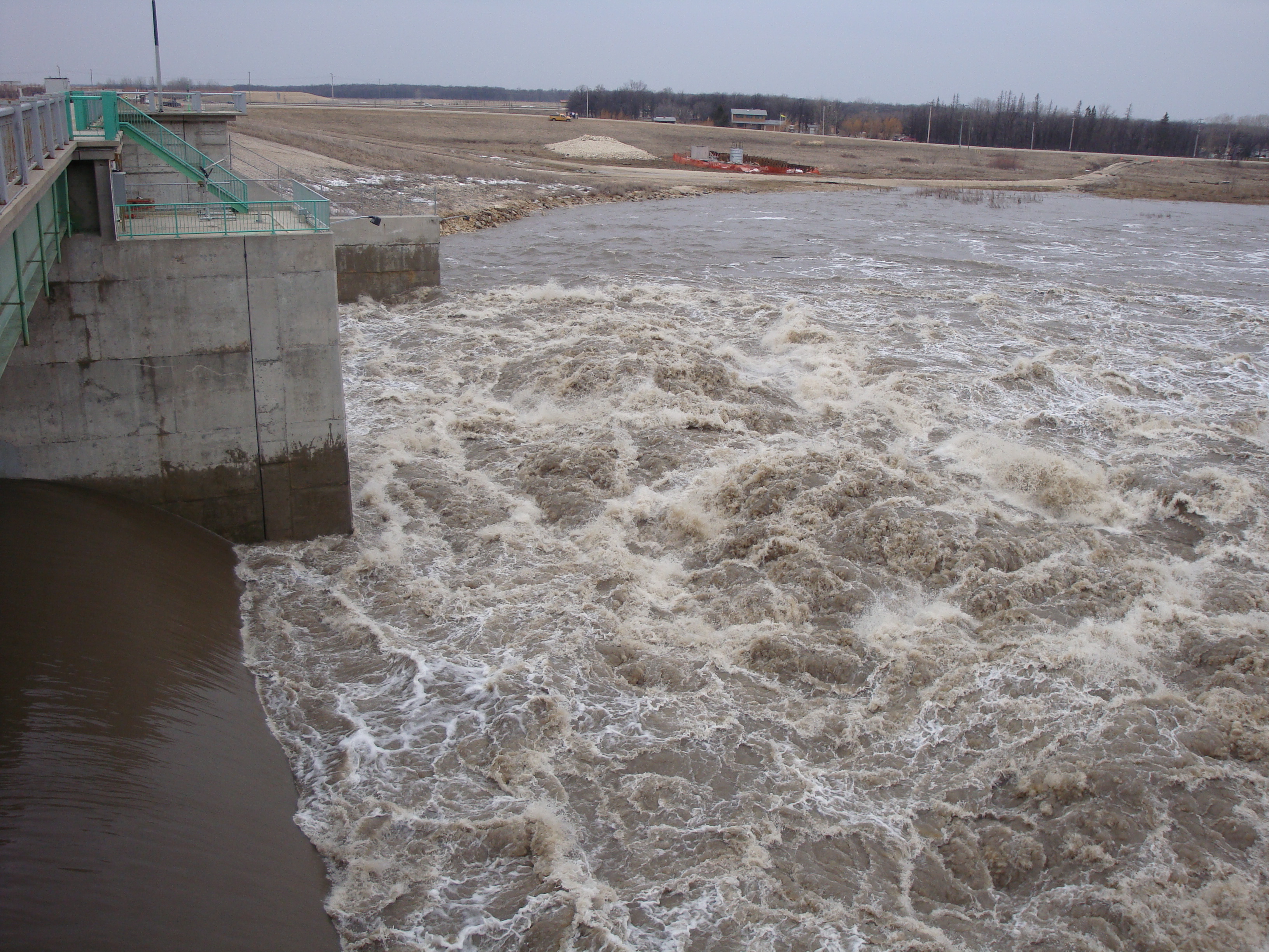
Historic Flood - 1979
The 1979 flood represented the first major test of the Red River Floodway. The natural peak flow at James Avenue was roughly equivalent to the flow of the 1950 flood. The flood was caused by a combination of the following:
- a long period of intense cold resulted in a continuous accumulation of winter snowfall
- heavy snowfall south of the border in February and above normal precipitation totals throughout the basin in March and April
- below normal temperatures in early April resulting in a late and sudden thaw throughout the basin
- above normal precipitation north of the border during the first two weeks of May
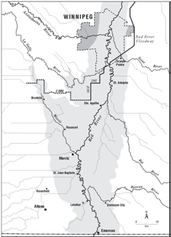
Ring dikes around St. Adolphe, Morris, Letellier, Dominion City, St. Jean Baptiste, Emerson, Rosenort and Brunkild protected properties within these dikes but the majority of residents, as well as those located outside were forced to evacuate.
The floodway was operated in coordination with the Shellmouth Reservoir and the Portage Diversion to limit the Red River water level to 5.8 metres (19.1 feet) at James Avenue. Without the use of the major flood control structures, the natural water level at James Avenue would have been approximately 9.2 metres (30.3 feet). At the time, the Red River flood of 1979 represented the fifth largest flood on record for the City of Winnipeg.
 |
 |
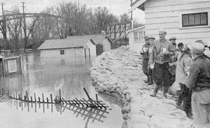
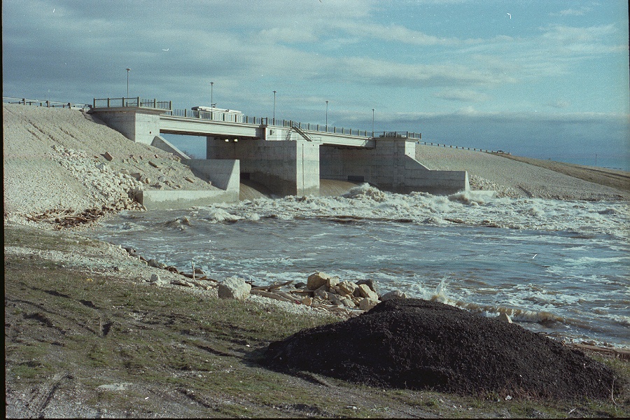
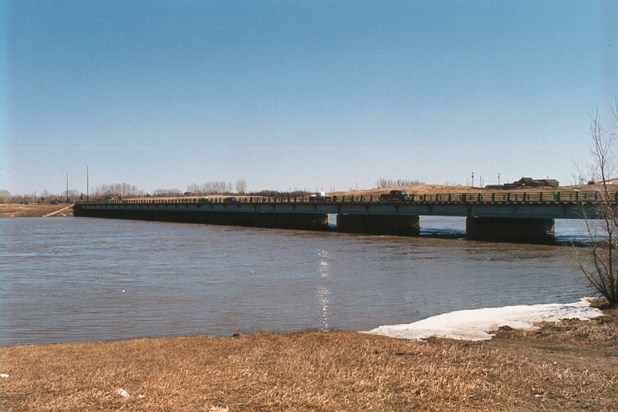
| Red River Floodway Inlet Control Structure, 1979 | Sturgeon Creek at Portage Avenue, 1979 |
 |
 |
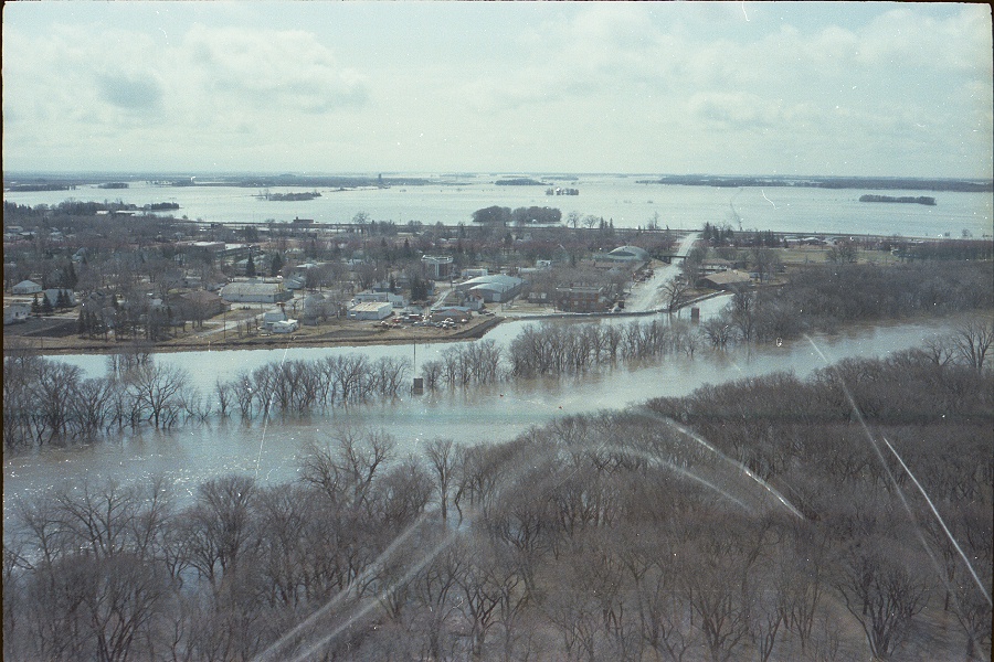
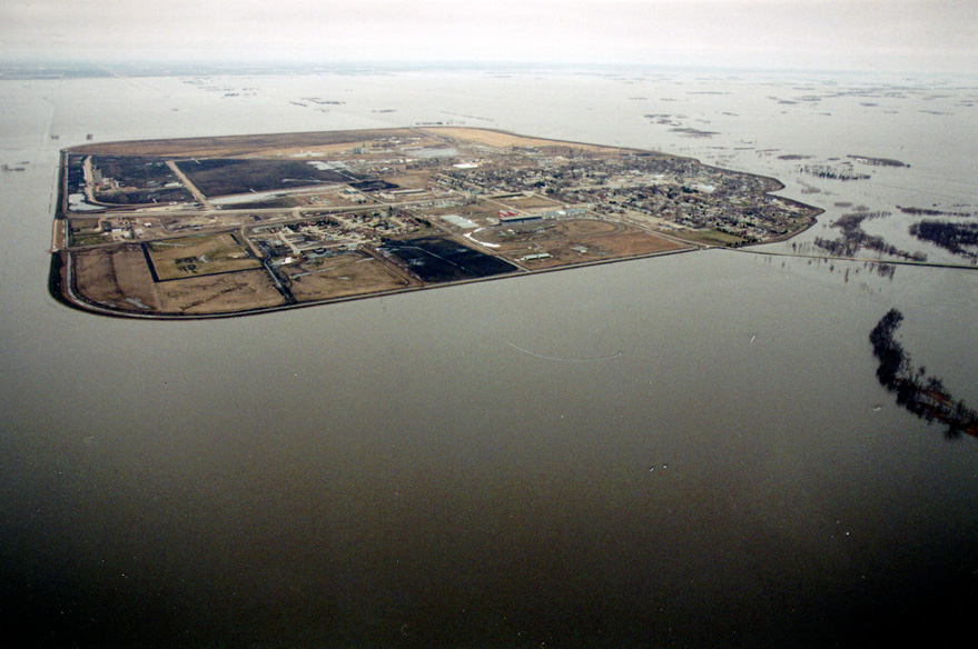
| Aerial image of flooding at Emerson, 1979 | Crew members filling sandbags in Winnipeg, April 30, 1979 |
 |
 |
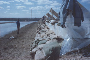
| Flashboarding in St. Adolphe, 1979 | Aerial image of flooding at St. Jean Baptiste, 1979 |
Reports
Please visit the reports page for all Red River Flood Reports
Historic Flood - 1997
The flood of 1997 was the most severe in Manitoba's Red River valley since 1852. Flooding in the Red River basin also saw high running water on other Manitoba rivers and the Red River flood directly or indirectly affected communities in:
|
|
|
A dry summer in 1996 was followed by heavy rain in the fall that greatly increased soil moisture, creating the possibility of flooding. The winter of 1996 was unusually long and cold. There were four blizzards with high winds and heavy snow that caused extensive drifting and made it hard to measure snow levels accurately. Total basin precipitation, from the start of winter to near the crest of the Red River in early May, totalled 221 millimetres (8.9 inches), well above the norm of 130 millimetres (5 inches). This figure may be underestimated because of the difficulty in accurately measuring drifting snow levels.
Gradual spring melting started in late March. A Colorado low at the beginning of April brought major snowfall of up to 90 millimetres (3.5 inches) to the Red River Valley. Melting resumed in mid-April and happened quickly.
Spring runoff volume for the Red River at Emerson (up to June 15) was 8.33 million cubic decametres (6.75 million acre-feet), representing an average runoff depth of 135 millimetres (5.3 inches). This is almost identical to the 1950 runoff volume. The runoff in spring 1997 was especially heavy in several areas:
- where the Red River starts near Halstad, North Dakota
- in the lower Pembina River Watershed
- on the eastern-most tributaries of the Red River in Manitoba
Many streams in these areas had record or near-record high water flow.
The Red River crested at approximately 7.5 metres (24.5 feet) at the James Avenue Pumping Station in Winnipeg. Without the flood control works, the crest would have been at 10.5 metres (35 feet).
Over 7,000 military personnel were employed for 36 days to help prevent flood damage and relocate 25,450 evacuees. An estimated 1,000 homes were damaged.
 |
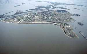 |
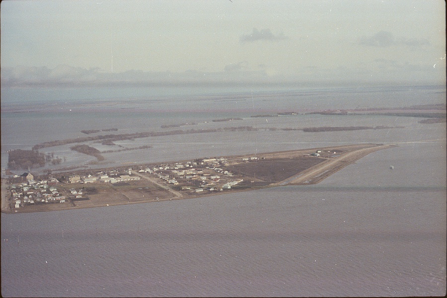
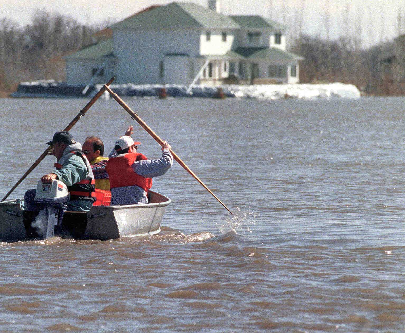
| Three men boating in a flooded residential area, 1997 | Aerial image of flooding outside of the Emerson ring dike, 1997 |
 |
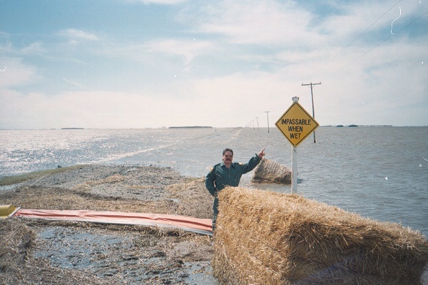 |
| Peak water levels just below PTH 59 in the floodway channel, 1997. | Man standing before a flooded road pointing to a sign that states "IMPASSABLE WHEN WET", 1997 |
 |
 |
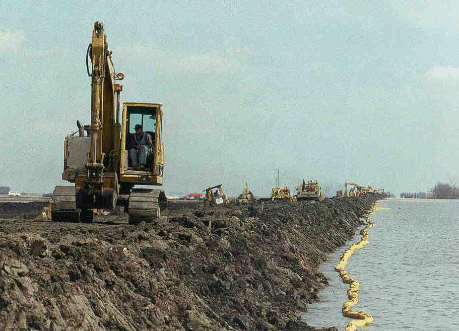
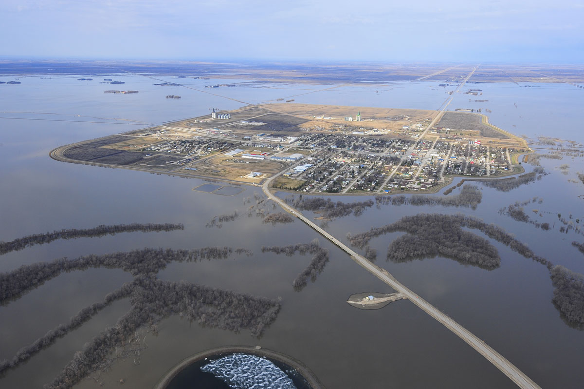
| Machines working on the West Dike during the flood of 1997 | Aerial image of flooding around the Morris ring dike, 1997 |
 |
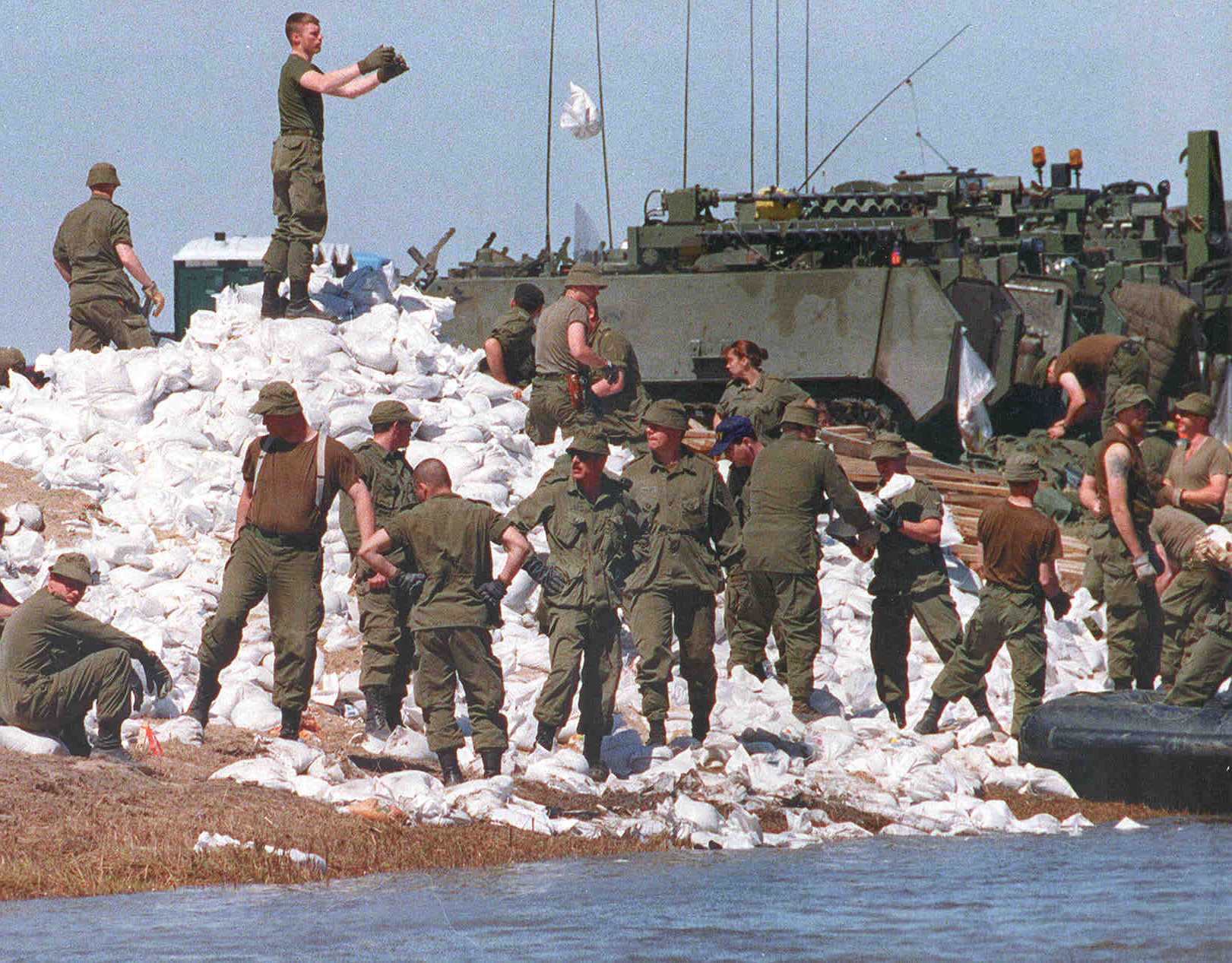 |
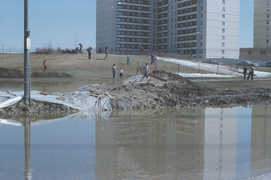
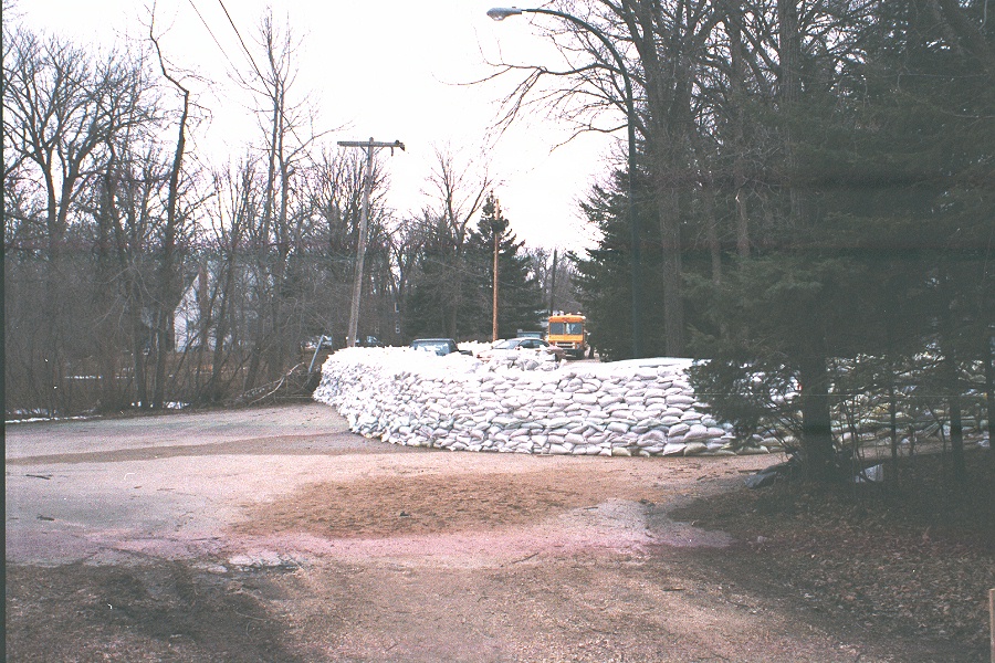
| Construction of a sandbag dike in St. Norbert, 1997 | Soldiers tossing sandbags during the flood of 1997 |
 |
 |
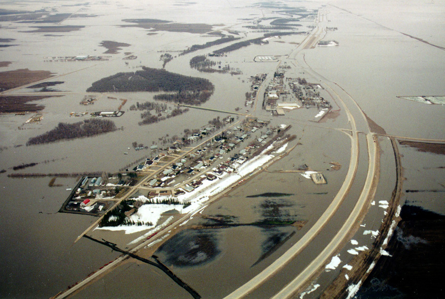
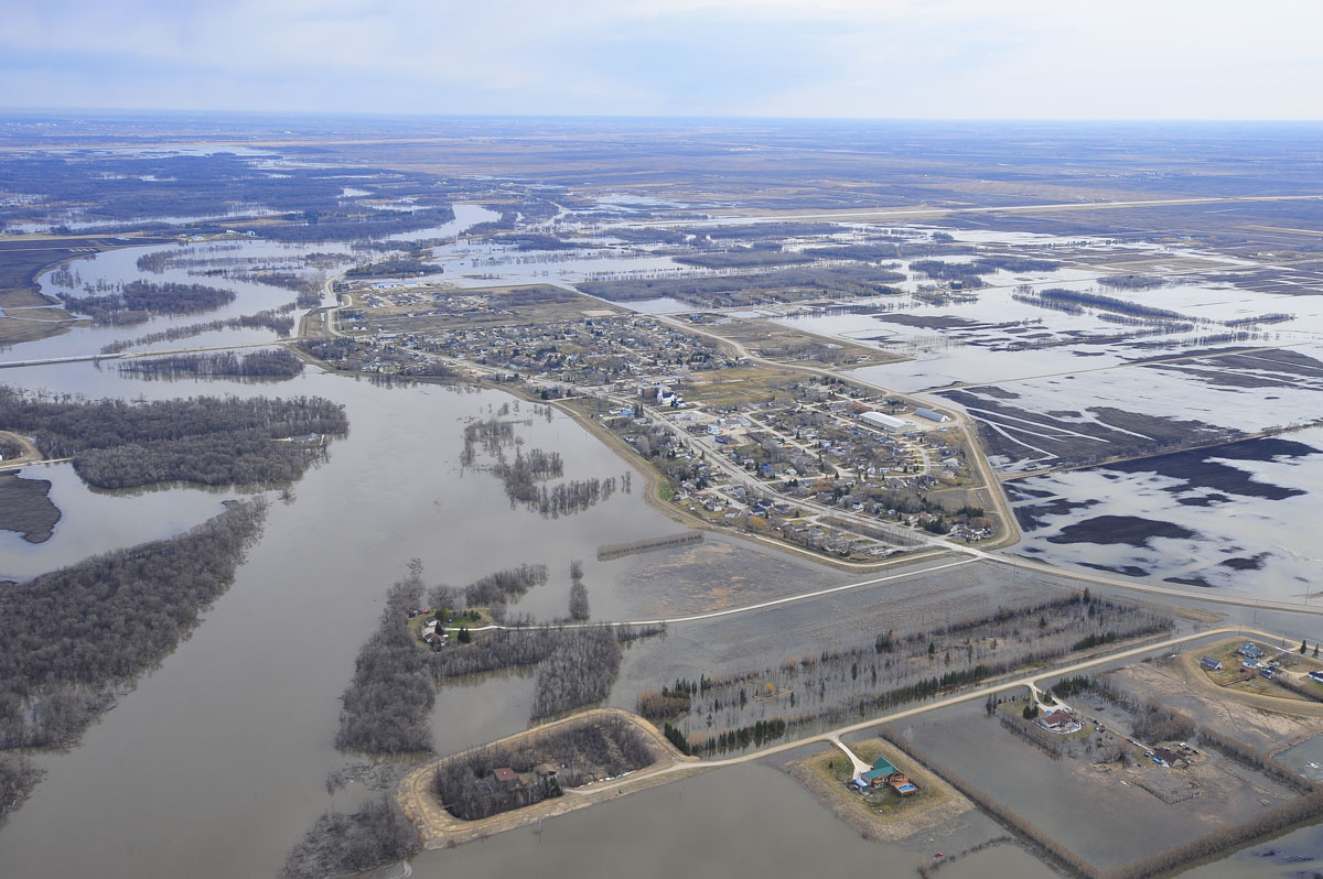
| Aerial image of flooding at Ste. Agathe, 1997 | Aerial image looking southwest showing flooding along West Dike, 1997 |
Links
- Flood of the Century (City of Winnipeg)
- The 1997 Red River flood in Manitoba, Canada (WF Rannie, University of Winnipeg)
- Red River Flood (The Canadian Encyclopedia)
Reports
Please visit the reports page for all Red River Flood Reports
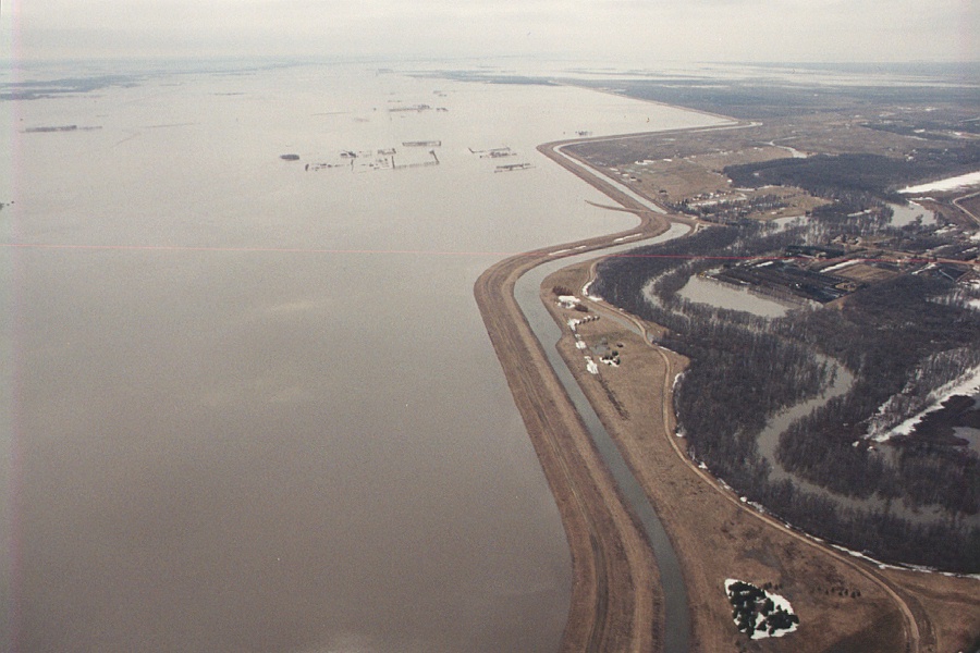
Historic Flood - 2009
The 2009 spring flood was the fourth highest on the Red River in Manitoba, since 1826. Flood forecasts in February and March 2009 indicated the likelihood of spring flood levels between those of the 2006 and 1979 floods with less than a 10 per cent chance of a flood as large as that of 1997. Spring precipitation was close to average and the melt rate was not unusually fast.
A heavy rainstorm in the first week of November, 2008 was a major factor in the flood. A high level of ground frost from a cold winter kept the ground from absorbing much of the spring runoff. Above average snowpack in the U.S. part of the watershed also contributed to the flood.
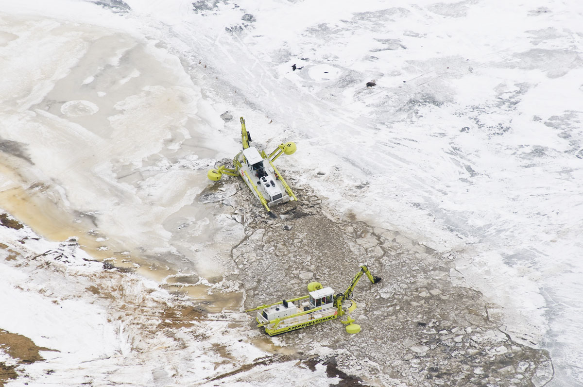
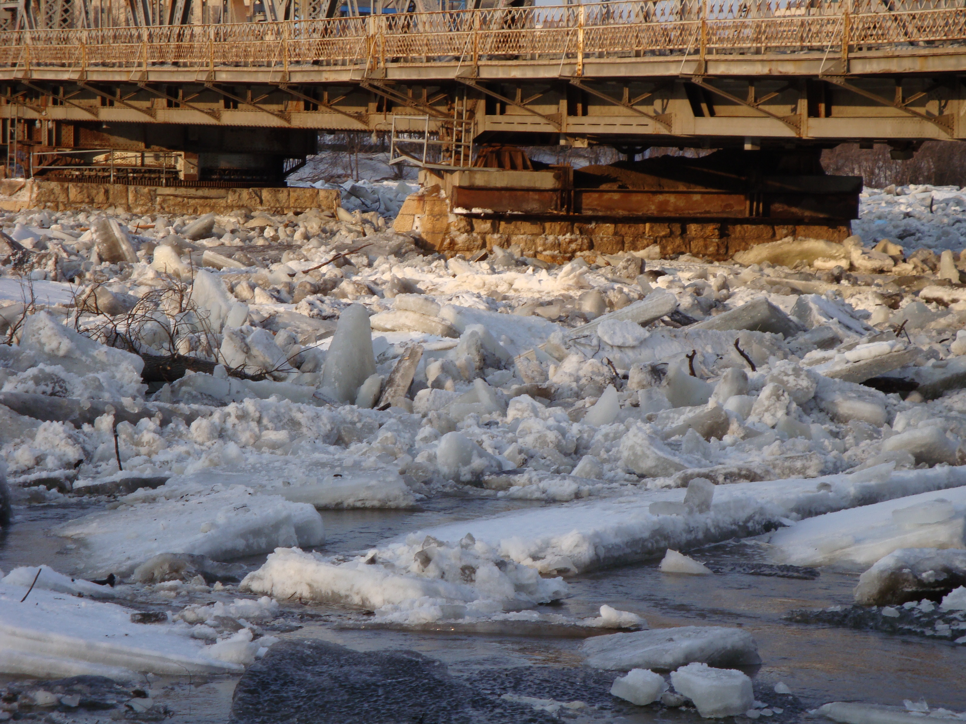
Flooding in the Red River watershed was worse due to unusual ice conditions, which caused blocks in the drainage system and raised river levels beyond what would have occurred under normal conditions. Ice jams in the Breezy Point and St. Peters Road areas north of the floodway outlet raised the Red River about 2.74 metres (9 feet) overnight, at up to 0.6 metres (2 feet) an hour, to record levels. Serious ice jams from Lockport to Lower Fort Garry in the last week of March raised levels in the area to within 0.3 metres (1 foot) of the 1997 crest.
If there had been no flood control works, the crest would have been 9.9 metres (32.5 feet) at the James Avenue Pumping Station in Winnipeg. The river crested in Winnipeg at 6.9 metres (22.5 feet) on April 16, at 0.6 metres (2 feet) lower than in 1997.
The greatest success of the 2009 flood was the protection provided by operation of major flood controls. Operation of the Red River Floodway, Portage Diversion and Shellmouth Reservoir reduced the crest in Winnipeg by 10 feet, preventing billions of dollars in damages. An estimated 250 homes were damaged.
 |
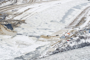 |
| Amphibex ice breakers move into Red River near Selkirk, 2009 | Aerial image showing river ice formation near the Red River Floodway Outlet Control Structure, March 31 2009 |
 |
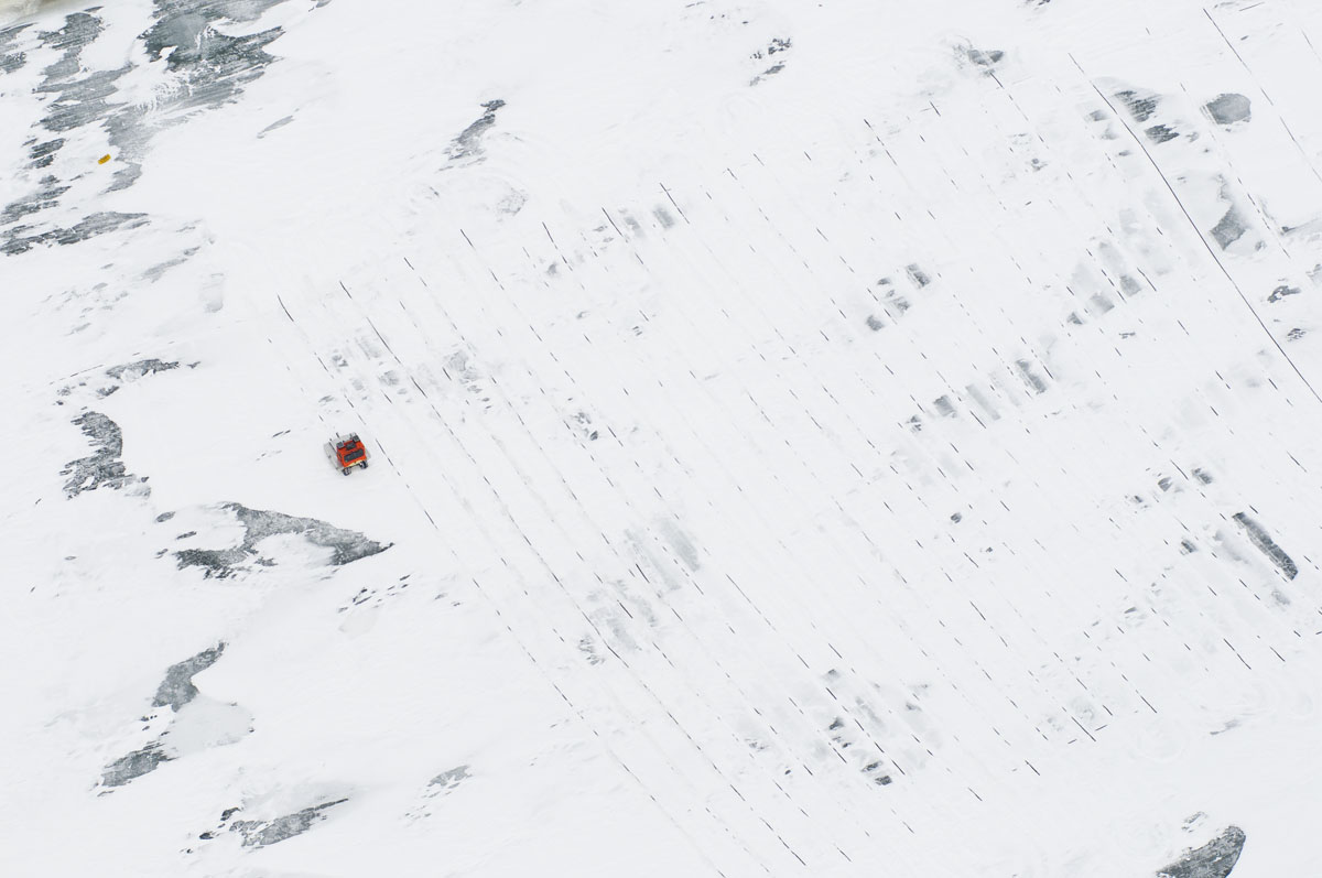 |
| Water flowing through the Red River Floodway Inlet Control Structure, 2009 | Aerial image of patterns on Red River ice near Selkirk made by ice cutter, March 31 2009 |
 |
 |
| Aerial image of ice jamming in Red River floodway channel, April 9 2009 | Aerial image of ice pans at Red River Floodway Inlet Control Structure, April 9 2009 |
 |
 |
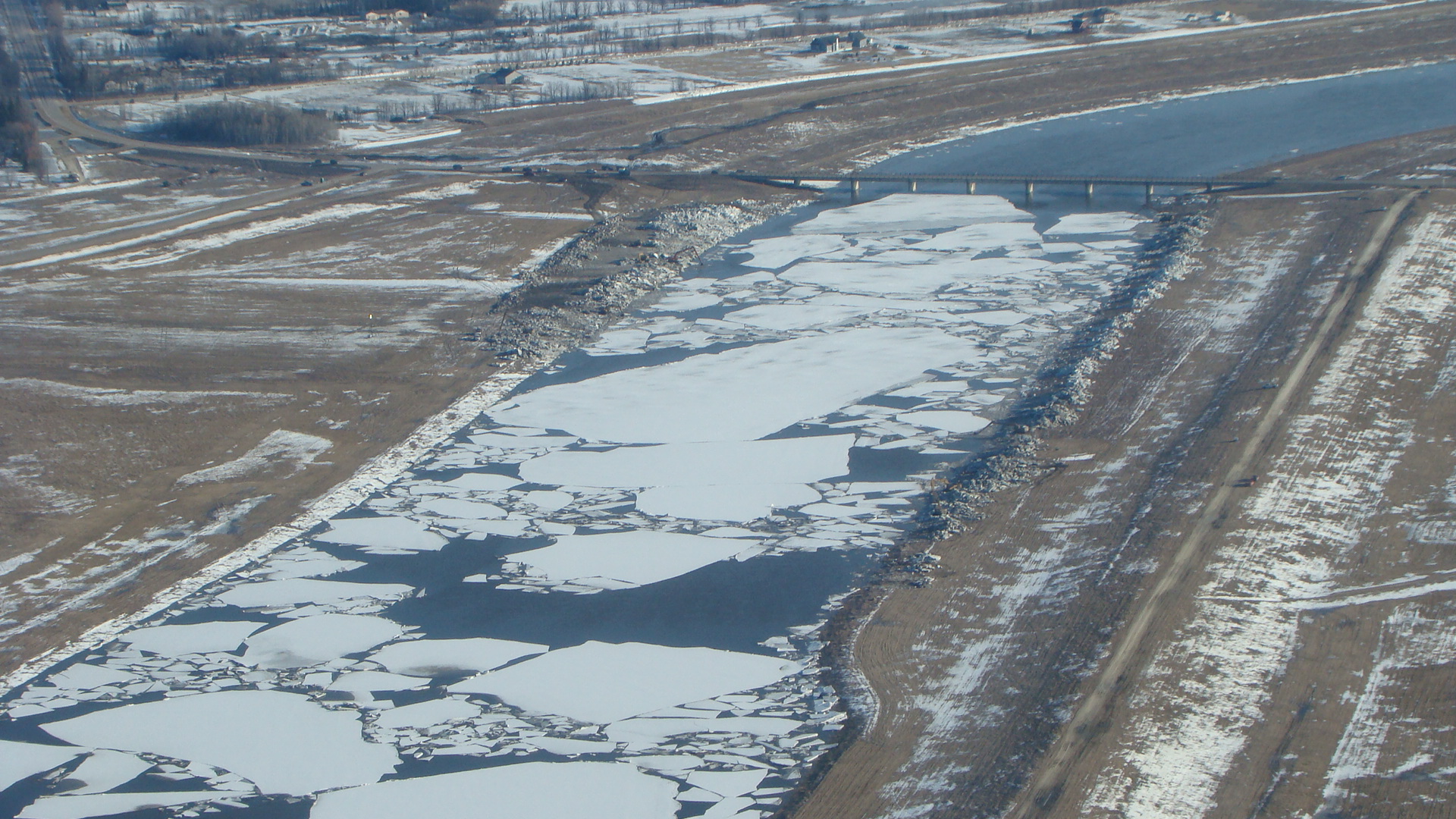
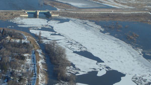
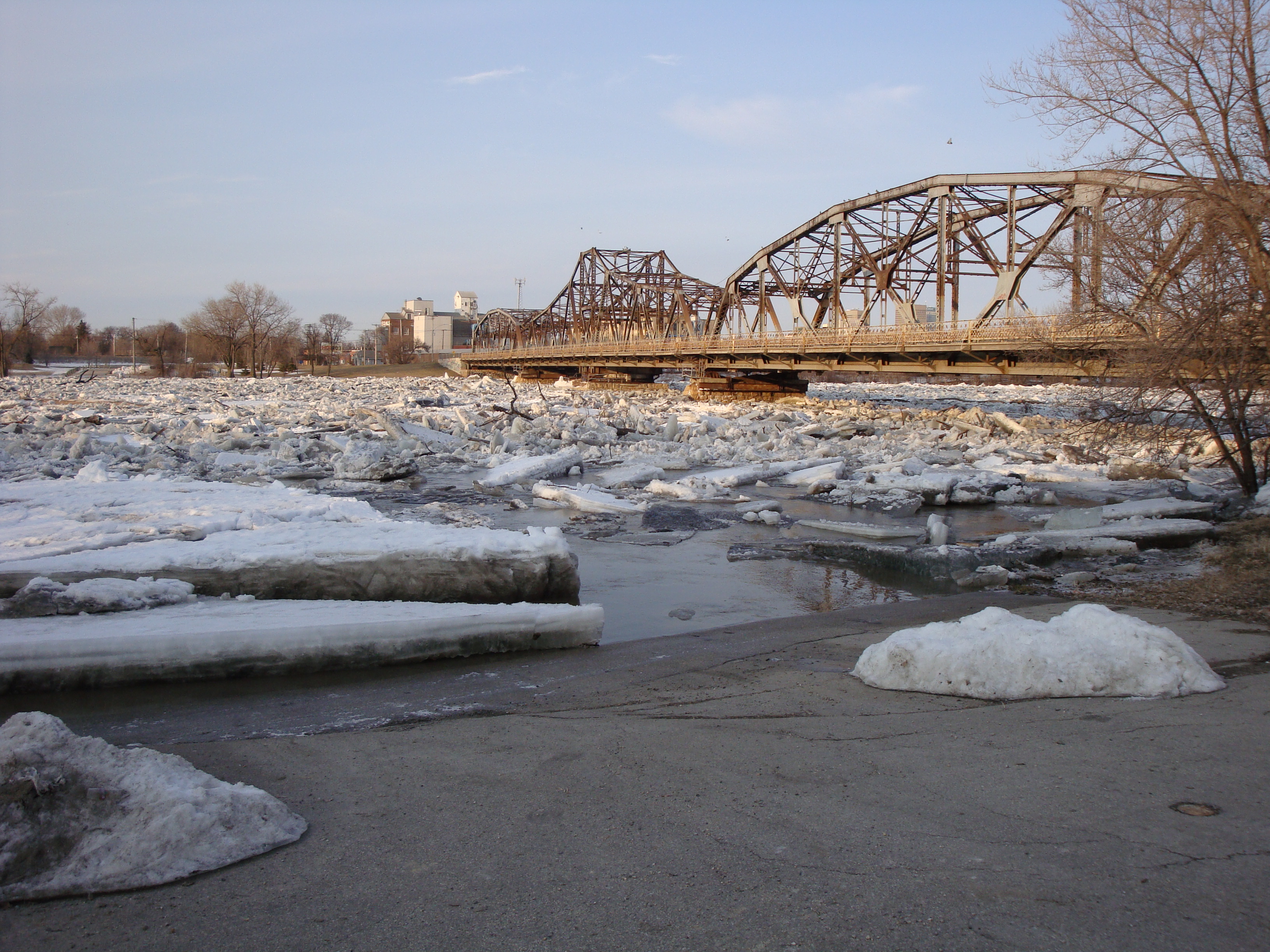
| Ice jam at Louise Bridge, April 11 2009 | Ice jam at Louise Bridge, April 11 2009 |
 |
|
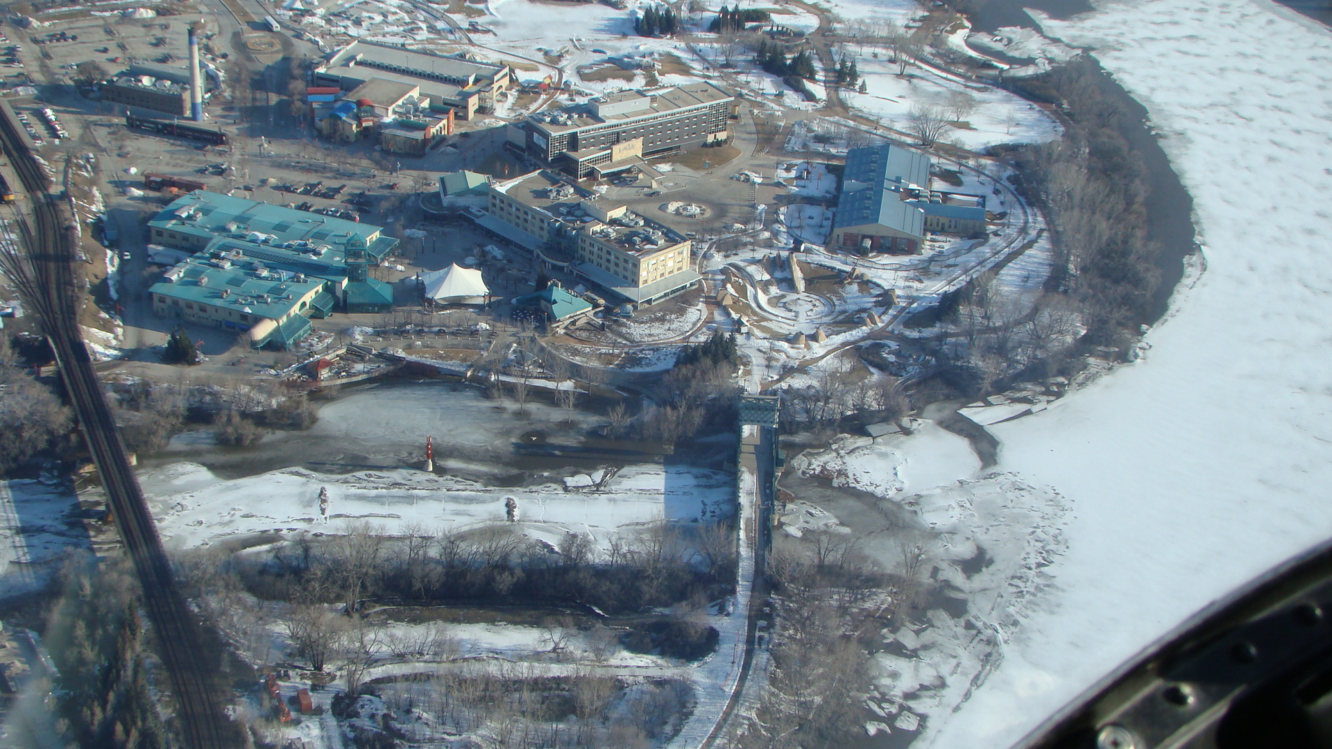
| Aerial image showing ice formation at the Forks in Winnipeg where the Red and Assiniboine Rivers meet, April 9 2009 |
Links
- https://en.wikipedia.org/wiki/2009_Red_River_flood
- http://www.cbc.ca/news/canada/manitoba/flood-2009-already-manitoba-s-third-worst-in-100-years-officials-1.855078
- https://news.gov.mb.ca/news/index.html?archive=week&item=6414
Reports
Please visit the reports page for all Red River Flood Reports
Historic Flood - 2011
In late October 2010, southern Manitoba was within a millimetre of having its wettest year on record, when a super-charged weather bomb dumped 50 to 100 millimetres of rain and snow. At freeze-up, soil moisture levels were the second highest since 1948; only 2009 had more. Cold temperatures throughout the winter resulted in deep soil frost penetration, meaning spring melt water was likely to spread out instead of soaking in. At the season's midpoint, the snowfall total was at a 15 year high.
When spring arrived, cold temperatures slowed the melt and delayed expected flooding. By mid-April, there was still plenty of snow on the ground and nowhere for the water to go when it melted. Then came heavy spring precipitation, with rain and snow that added to an already bad flooding situation. Waters rose steadily in several lakes and in rivers including the Red, Assiniboine, Souris, Pembina and Qu'Appelle.
In early April 2011, Manitoba declared a high flood risk for six rivers, including two that pass through Winnipeg. The Red River peaked in Winnipeg on April 7, when an ice jam drove up water levels. The high stage ranked third largest in the past 150 years. The Assiniboine River crested just days later.
Once again, the Red River Floodway saved the day, along with some help from nature when no major rain or snow fell in the area during April, May or June.
On May 9, the Manitoba government declared a province-wide state of emergency, issuing evacuation notices for several municipalities along the Assiniboine River. Brandon was at the epicentre of a months-long flood battle, in which the Assiniboine River reached its highest level since 1923 and continued to rise. The river was nearly seven metres higher and 20 to 30 times wider than normal in some places. Flooding on the Assiniboine near Brandon lasted 120 days and was the largest on record.
In late May, Lake Manitoba, Lake Winnipeg and at least four others reached record water levels. Hundreds of residents and cottage owners were ordered to leave because of high winds and waves. Lake levels were higher than 1955 levels that were previously the highest recorded levels. The 2011 levels were enhanced by water diverted from the Assiniboine River. A late May 2011 storm with strong north winds sent water crashing against dozens of homes at Delta Beach on the south shore of Lake Manitoba. The inundation was so far inland that beachfront cottages were now located three kilometres into the lake beyond the flood shore. Spring flood peaks for 2011 were:
- Emerson - 240.9 metres (790.3 feet) asl
- Morris – 237.5 metres (779.3 feet) asl
- Winnipeg – 6.0 metres (19.6 feet) James Avenue datum - nearly three feet lower than in 2009)
- Selkirk – 220.7 metres (724 feet) asl
The 2011 flood featured the highest water levels and flows in modern history across parts of Manitoba and Saskatchewan. Statistically, the flooding on the Assiniboine River in 2011 was estimated to be at levels experienced once in 330 years. On Lake Manitoba, engineers called the flood a one-in-2,000-year event. Governments at all levels spent close to $1 billion on flood fighting and compensation (Environment Canada).
Epic snow melts occurred everywhere – from the Qu'Appelle Valley to eastern Manitoba and from The Pas south to the Canada-U.S. border – resulting in more acreage under water than ever recorded.
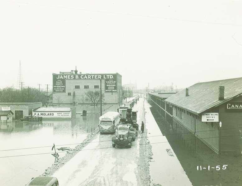
Because of the unprecedented flooding in 2011, an emergency outlet channel was built to drain floodwater from Lake St. Martin and Lake Manitoba into Lake Winnipeg. The channel opened on November 1, 2011. More than 130 workers and over 100 pieces of heavy equipment were involved in the construction project.
About 7,100 Manitobans were displaced from their homes, with 2,700 still evacuated at the end of the year. Flooding affected three million hectares of farmland, requiring ranchers to move thousands of livestock. Local states of emergency were declared in 70 Manitoba communities. Floodwater forced the closure of 850 roads, including parts of the Trans-Canada Highway. The massive flood fighting effort involved thousands of emergency measures officials and volunteers, including inmates from a local jail and 1,800 members of the Canadian military.
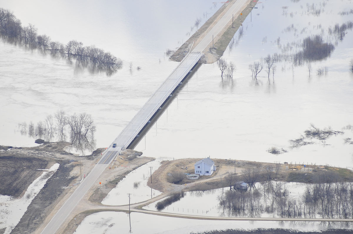
 |
 |
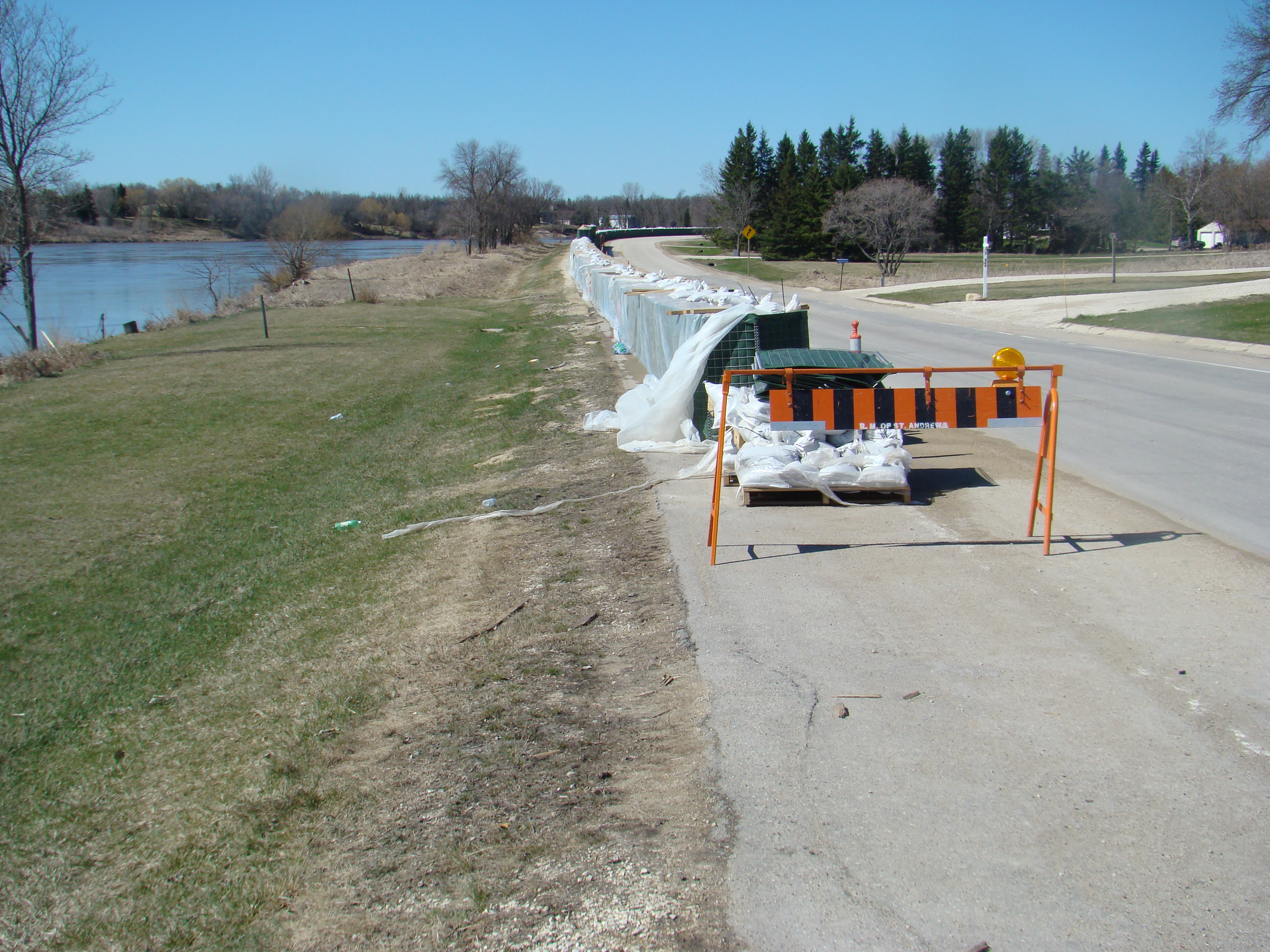
Flood Protection on Road north of Winnipeg, 2011 |
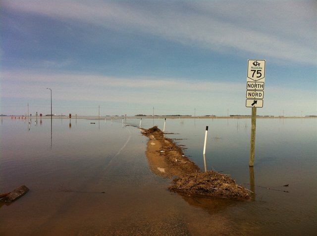
Flooding of Highway 75, 2011 |
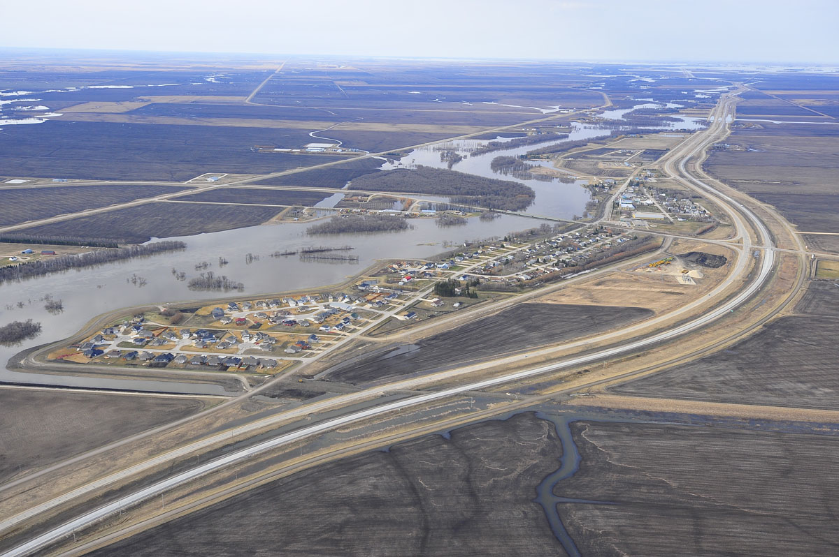
 |
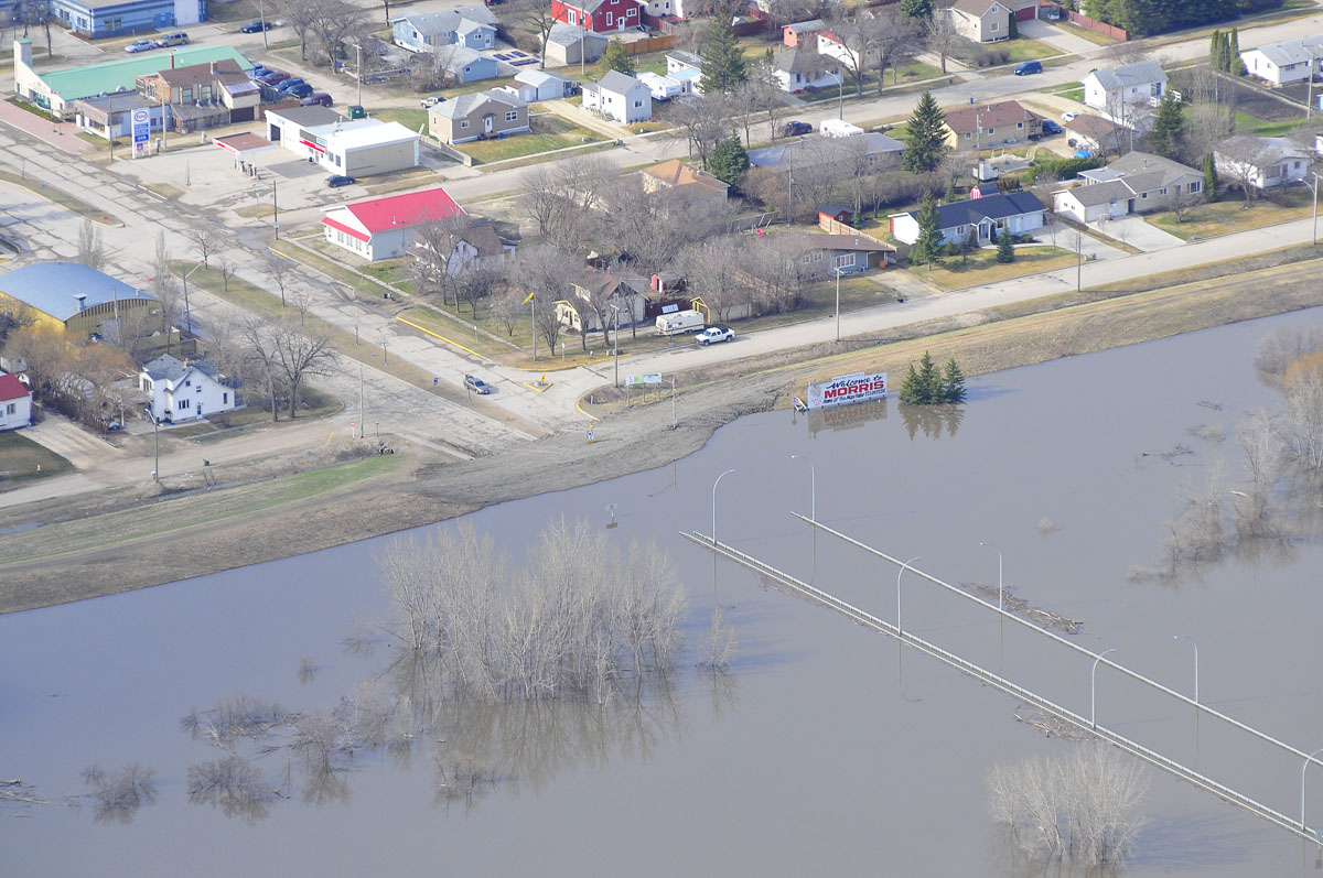 |
| Aerial image of flooding outside of the Morris ring dike, 2011 | Aerial image showing the Morris bridge under water, 2011 |
 |
 |
Aerial image of flooding outside of Roseau River First Nation, 2011 |
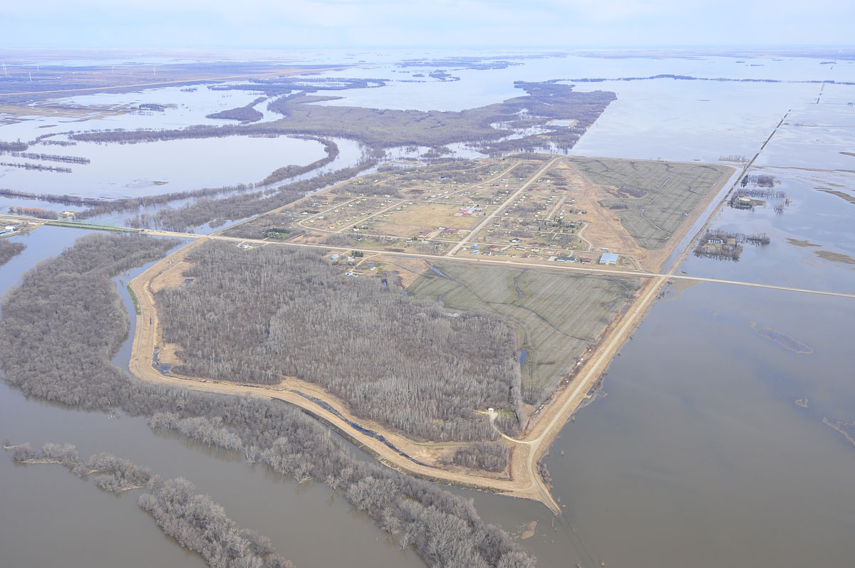
Aerial image of flooding outside of the St. Adolphe ring dike, 2011 |
 |
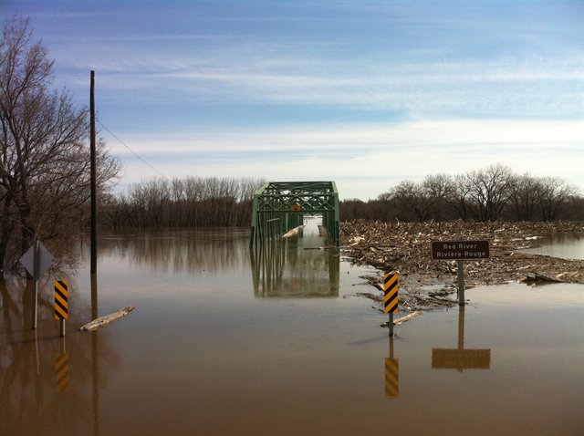 |
| Aerial image showing high flows under the St. Adolphe Bridge, 2011 | St. Jean Bridge Under Water, 2011 |
 |
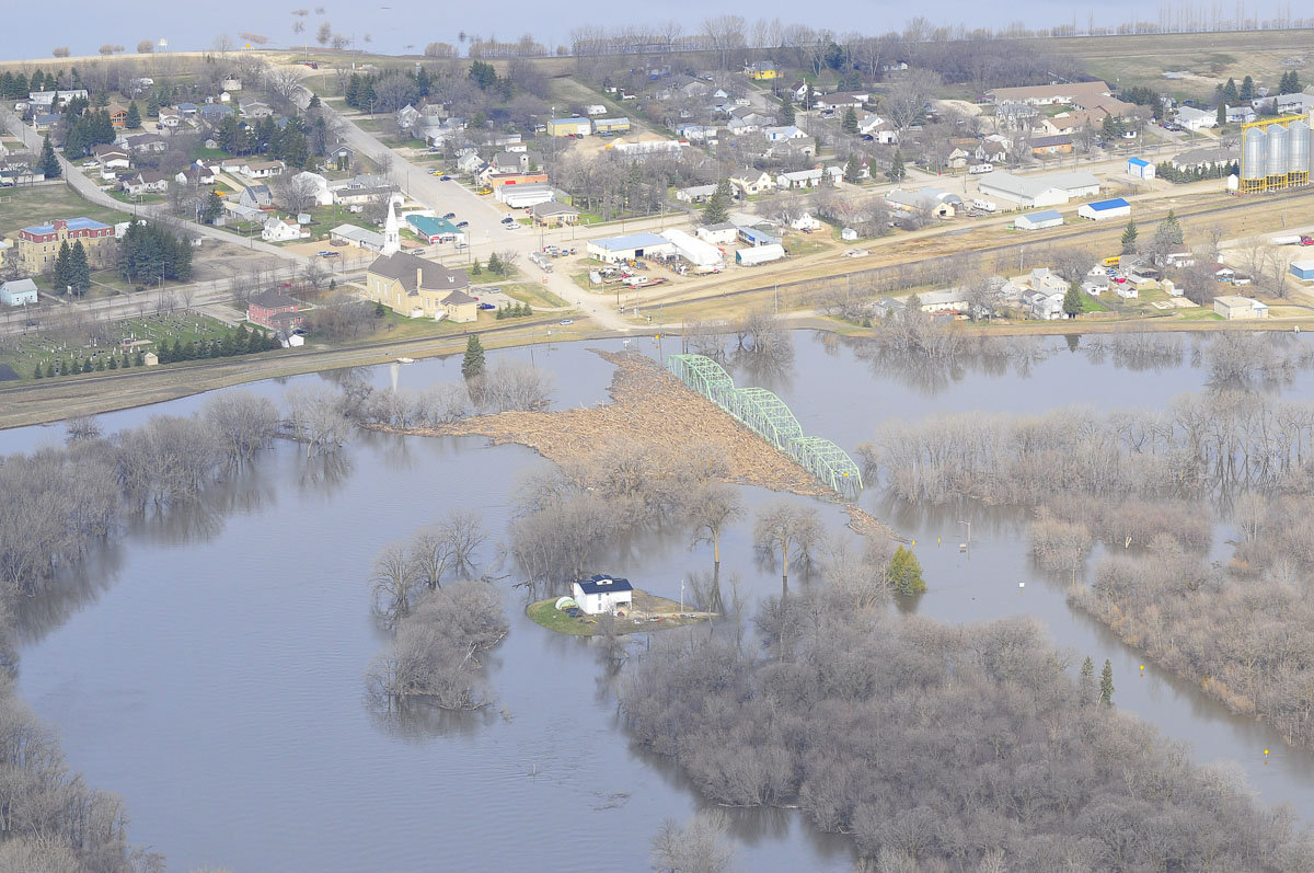 |
| Aerial image of flooding outside of the Ste. Agathe ring dike, 2011 | Aerial image of flooding around the St. Jean Baptist Bridge, 2011 |
Reports
Please visit the reports page for all Red River Flood Reports